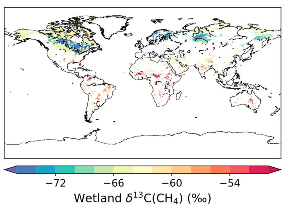
Based on measurements compiled from the past couple of decades on the wetland d13C-CH4 isotopic source signatures from different wetland ecosystems, we have produced a spatially-resolved gridded map. This map distinguishes bogs and fens in the northern high-latitudes, which have dramatically different signatures due to the fundamental differences in hydrology, and C3 and C4 wetlands in the tropics, which utilize different photosynthetic pathways.
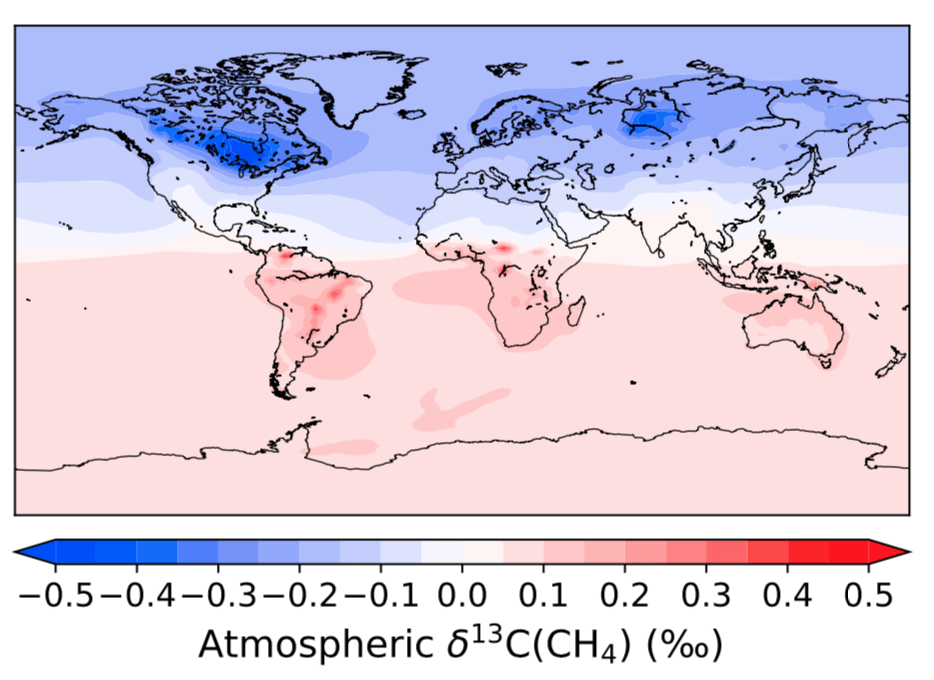
We show with this new gridded distribution the effect of not accounting for these variations in global CH4 simulations. Most previous studies either assume a single globally uniform source signature or a value for the tropics and the high-latitudes. These assumptions result in a large bias in atmospheric simulations that are a size comparable to variations in the atmosphere.